

Faroe Islands travel guide
The Faroe Islands are one of the most extraordinary places in Europe. This is a destination that is hard to compare with any other. Eighteen green islands are scattered somewhere between Iceland, Scotland, and Norway, often shrouded in mist, rain, and wind. The Faroes are an autonomous territory of the Kingdom of Denmark. However, they have a strong sense of identity – their own language, flag, and parliament. The Faroese are incredibly proud of their Viking heritage, which is alive not only in museums but also in everyday life, characterised by independence, resilience, and a deep-rooted tradition.
Did you know that the name Faroe Islands comes from the Old Norse Færeyjar, meaning Sheep Islands?

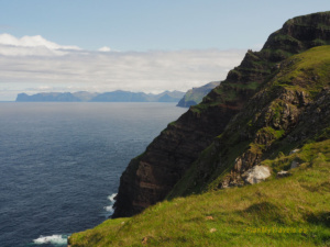
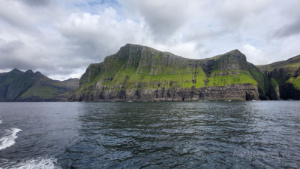
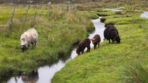
Here, there are nearly two sheep for every person, and one church for every ten houses. The towns are tiny, while the open spaces are vast. Cliffs rise to 700 meters, with thousands of birds nesting along their edges: puffins, guillemots, gulls, and fulmars. Their cries are often the only sounds you hear apart from the wind. The islands feel empty and wild, yet they are incredibly photogenic – perfect for those seeking silence, nature, and a touch of Nordic melancholy.
Below you will find our plan for a 10-day trip around the Faroe Islands. This route allowed us to see the most spectacular spots of the archipelago. Unhurried, with plenty of space to marvel at the views. I wholeheartedly recommend this itinerary to anyone who wants to truly feel the spirit of these extraordinary islands.
Day 1 – First Faroese Cliffs
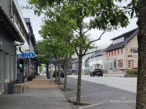
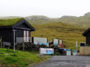
We land at Vágar Airport in the early afternoon. We pick up our car, pocket Wi-Fi, and drive to our hotel in the village of Sørvágur. After dropping off our luggage, we dress appropriately for the weather and set off on our afternoon route.
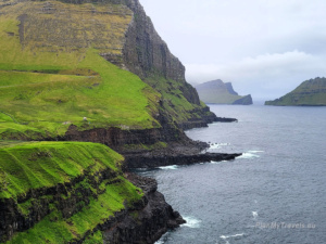
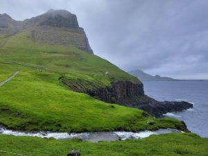
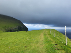
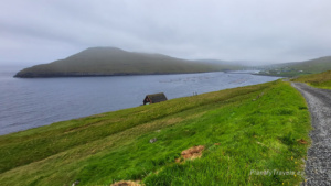
Afternoon route: from Sørvágur to Gásadalur

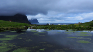
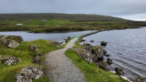
Our first destination is the small village of Gásadalur. It is hidden among the mountains, from whose cliffs flows the famous Múlafossur waterfall. Yes, precisely that is one of the most iconic spots on the Faroe Islands. This is the image that often appears on guidebook covers. Despite its popularity, the place still feels wild and peaceful. This may be because until 2004, it could only be reached on foot across the mountains.


The drive takes about 20 minutes from the airport. The road passes through a tunnel carved into the rock and terminates at a small parking area adjacent to the village. From there, a short walk leads to the cliff – the path starts at the first house on the left. It is worth descending the steps to see the waterfall up close while also enjoying the whole panorama of Gásadalur with Mykines in the background.


Practical information:
- On the way to Gásadalur, it is worth stopping in Bøur. It is a picturesque village with views of Tindhólmur and the distant outline of Mykines. You can park at the small lot by the characteristic brown house or take the side road just behind it.


- Drive carefully, as it is easy to encounter wandering sheep on the road.
- In Gásadalur, there is a small puffin colony near the cliffs – consider not missing them along the way.

- A small parking area is located by the bus stop in the village centre. There are also public toilets.
- All car rental companies on the Faroe Islands are situated at Vágar Airport. We booked our car via the Guide to the Faroe Islands* website, and I was pleased with their service.
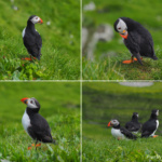
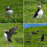
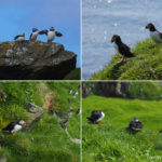
Day 2 – Mykines: Puffin Island and Life in Harmony with Nature
Mykines is one of the most magical places on the Faroe Islands – a wild, untouched island on the far western edge of the archipelago, known primarily for its numerous puffin colonies, which arrive here to breed during the bright summer months.

A trip to Mykines is not just about seeing these charming birds, but also a unique lesson in living in harmony with nature and building a strong, supportive community in a harsh yet beautiful environment.


SELECTED TOURS AND FERRY TICKETS TO MYKINES
Tours to Mykines are very popular, and the number of spots on the boat is limited (max 70 people per ferry). It is recommended to book tickets in advance to avoid disappointment.
- Mykines Shuttle Boat*, 4h
- The Classic Mykines Tour*, 9.5h
- Amazing 5.5 Hour Day Tour to Mykines Island*
- The Mykines Ferry, 45 min one way*

Why Visit Mykines?
Although the cost may seem high, it essentially helps preserve the island’s unique character and protect its natural environment. The island is not overcrowded with tourists, and local guides ensure that visitors respect both the natural environment and local customs.
During a full-day trip, you will not only see puffins but also experience the rhythm of life in the small local community. Everyone knows each other and supports one another; cleanliness, order, and environmental care are top priorities. The residents of Mykines have learned to live in harmony with nature, respecting natural cycles, protecting bird colonies, and sharing their daily lives with visitors who want to understand this unique culture.
What to Expect on Mykines:
- Meeting the puffins – walk near the colonies of these charming birds, which come here to breed and raise their chicks. Their colourful beaks and awkward walk make an unforgettable sight.

- Seabirds – Mykines is also an important breeding site for other seabirds, including fulmars, storm petrels, gannets, cormorants, kittiwakes, and guillemots. Most nesting birds can be seen on the cliffs and around the lighthouse.


- Sheep – in addition to puffins, you will also encounter sheep, which vastly outnumber the human residents. They are an essential part of the island’s landscape and culture.

- Nature in its purest form – rugged cliffs, vast green meadows, and the surrounding ocean creates a spectacular backdrop for this exceptional island.
- Home hospitality – access to one of the few homes on the island, where you can rest with a tasty fish soup and homemade cake while learning about the history and traditions of the locals.
- Island walk – explore the lighthouse and the best viewpoints, guided by a local who ensures the safety and comfort of the group.

This trip is a true lesson in how humans can coexist with wild nature, respecting it and drawing strength from it. It is a journey that leaves a mark on the heart and helps understand why the Faroe Islands are so special—not only for their landscapes but also for the spirit and traditions of their inhabitants.


Additional Information
- Visiting Mykines is only allowed with a guide. Independent exploration of the island is prohibited. This strict rule is in place to protect the delicate natural environment and ensure the safety of the thousands of puffins nesting here during the breeding season. Guides make sure the visit is conducted responsibly and with respect for nature.
- Puffins are not only a symbol of the archipelago but also an indicator of the overall health of the ecosystem. Their presence and numbers reflect the cleanliness of the waters and the state of the fish they feed on. That is why locals take care not to disturb them during the nesting season.
- Today, only a few families live on Mykines, earning a living from fishing and tourism. The community functions like a well-oiled machine—everyone knows their role and ensures order and safety for both tourists and birds.
- Even in summer, remember to dress in layers and bring a waterproof jacket. Wind and fog can appear suddenly, and the weather changes very quickly. This is part of the charm and the true face of the Faroes.
- Puffins are extremely curious, but be sure not to get too close or scare them. The best photos are taken from a distance using a zoom lens.
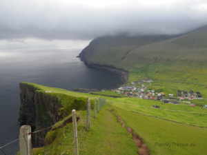
Day 3 – Streymoy and the Bird Cliffs of Vestmanna
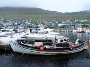
Today, we change islands and head to Streymoy, the main island of the archipelago, to the charming town of Vestmanna.
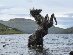
First stop: the Nix Demon Monument by Lake Sørvágsvatn. It is worth making a short stop here to see the sculpture of the mythical water horse from Faroese legends—a perfect spot for a photo and a brief break before continuing the journey.

Along the way, there are a few short stops for photos, including the towns of Sandavágur, Leynar, and Kvívík.


Next, we drive through the impressive Vágatunnilin undersea tunnel, which connects Vágar with Streymoy — one of the most important and spectacular infrastructure projects in the Faroe Islands.
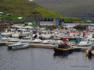
Vestmanna – port and bird cliff boat tour
In Vestmanna, we take a walk along the harbour and stop for lunch — an excellent opportunity to enjoy the seaside atmosphere and recharge before the afternoon activity.


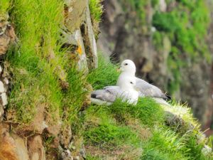
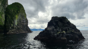
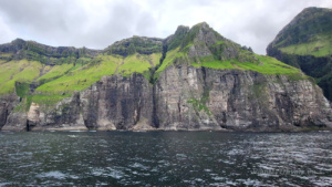
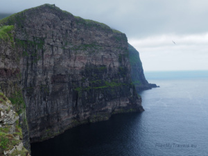
At 2:30 PM, our organised boat tour to the Bird Cliffs and sea caves begins — one of the oldest and most beloved tourist attractions in the Faroes. The trip lasts about 90–120 minutes and allows close-up views of spectacular natural phenomena:


- Cliffs where sheep graze on steep, almost vertical slopes — an imposing sight.
- Colonies of exotic seabirds nest on tall, freestanding rocks shaped by millions of years of erosion.
- Sea caves that the boat enters, giving a real sense of the power of nature and the ocean.
During the tour, the Guide will explain how these cliffs were once a source of food for the locals and how Faroese farmers still skillfully herd sheep from the otherwise inaccessible mountain sides.


This is a true journey into wild nature, so the boat captain has complete control over the route and can modify it if weather or sea conditions require. The weather in the Faroe Islands is changeable and very local — it cannot be accurately predicted based on forecasts from another island, such as Tórshavn.
After returning to Vestmanna, we drive to Tórshavn — the capital of the Faroe Islands. The journey is about 40 km and takes roughly 40 minutes by car. Once checked in at the hotel, take a relaxing walk around the area to soak up the city’s atmosphere and prepare for another day full of attractions.
SELECTED TOURS from Vestmanna
- Vestmanna Sea Cliffs Boat Trip*
- Fishing Trip in Vestmanna*
- Kayaking in Vestmanna*
- Vestmanna Sea Cliffs & Viking Village Tour*
- Vestmanna Seacliffs Sightseeing in the Faroes – Classic Tour*
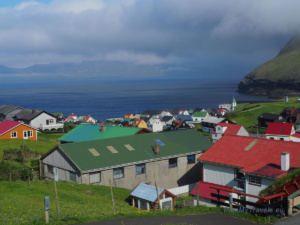
Day 4 – Tórshavn at a Leisurely Pace: The Heart of the Faroe Islands
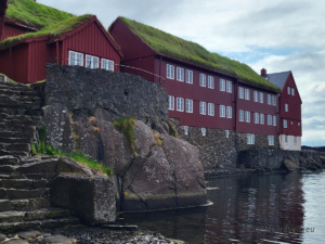
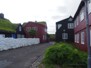
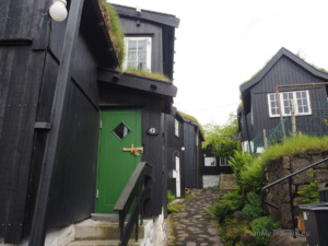
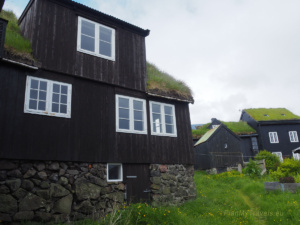
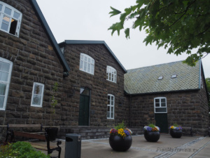
Tórshavn is the smallest capital in Europe, yet one of the most charming and atmospheric cities in the region. Founded by Vikings in the 9th century, it is today a modern political and cultural centre of the archipelago, while still retaining its historic character. The Old Town, known as Tinganes, with its wooden buildings and traditional turf roofs, is listed as a UNESCO heritage site as an exceptional example of a Nordic port settlement.

Tinganes and the Old Town
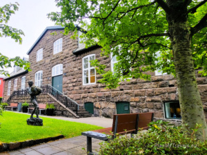
Walking through Tinganes, you will see historic red buildings, including Skansapakkhúsið — the seat of the Faroese government. Be sure to visit Munkastovan, the oldest building in the city, dating back to the 13th century. It was formerly a monks’ residence, featuring thick stone walls made of lime and crushed shells. In the area, you can also look for small curiosities — a kind of Easter egg, such as a wind rose or a sundial carved into the rock.


Harbour, Havnar Kirkja Cathedral, and Sacred Architecture
The port area of Tórshavn is a riot of colours — charming pastel-colored wooden houses reminiscent of famous Nyhavn in Copenhagen.


Next to it is Havnar Kirkja Cathedral, whose bell comes from the wreck of a Danish ship, adding historical significance. Nearby, you will find a cosy bookstore combined with a café — a perfect spot to buy postcards and small souvenirs.

If you want to see an interesting example of modern sacred architecture, head to the western side of the city, where Vesturkirkjan stands — the tallest building in Tórshavn and the entire archipelago. It measures 41 meters in height, with a sail-like shape that blends harmoniously with the surrounding landscape. The church was consecrated in 1975 and is now not only a place of worship but also one of the most distinctive landmarks in the capital’s skyline.


Art, History, and Green Spaces
- Nordic House – a modernist architectural gem combining glass, turf, and basalt, promoting the culture of the Faroe Islands and Nordic countries.
- Listasavn Føroya – the national art gallery, showcasing works by local painters and artists.
- Fort Skansin – a 16th-century fortress that once protected the city from pirates and played an essential role during World War II. The site also features a relatively low lighthouse, well-adapted to the island’s strong winds.


- Viðarlundin Park – the only mini-forest in the Faroe Islands, a peaceful green space with a monument commemorating fishermen who died during World War II.


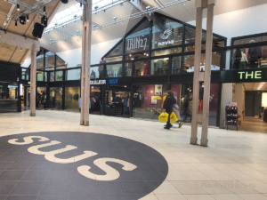
Along the way, you can also visit the SMS Shopping Centre, which offers clothing and cosmetics stores, a supermarket, a food court, and a small bookstore featuring souvenirs.
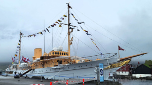
Meeting the Danish King
When we visited Tórshavn, we had the extraordinary opportunity to witness an official visit by the King and Queen of Denmark. They arrived on a beautiful yacht, which could be admired as it was moored in the harbour. The yacht left a considerable impression — still in the sunlight, it felt as if time had stopped. The entire scene resembled a frame from an old movie.

Additional Information:
- Since 1932, Danish monarchs have travelled on HDMY Dannebrog, named after the Danish flag. This floating palace serves both as a private royal retreat during summer cruises and as part of maritime surveillance and rescue operations. It has already sailed over 400,000 nautical miles, visiting the Faroe Islands, Greenland, and many ports across Europe. If you want to learn more about the Danish Royal Yacht, visit the official website.
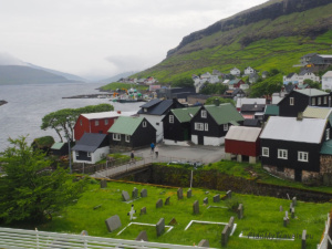
Day 5 – Kirkjubøur and a Boat Trip to Hestur’s Caves
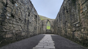
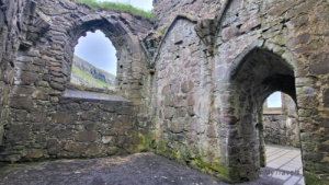
Today, we head south on the island of Streymoy to a place considered the spiritual and historical cradle of the Faroe Islands — Kirkjubøur. Located just a few minutes’ drive from Tórshavn, the village captivates with its raw atmosphere, open views of the ocean, and an extraordinary concentration of historic sites.
Kirkjubøur – The Heart of Faroese History
Here you will find:
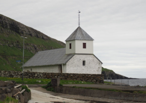
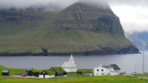
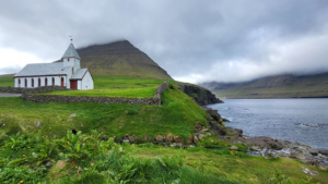
- St. Olav’s Church is considered the oldest still-functioning church in the Faroe Islands. Small but charming, it impresses with its simplicity and picturesque location right by the shoreline.

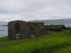
- The ruins of St. Magnus Cathedral, whose construction began in the 12th century but was never completed. Its stark stone walls still stand proudly against the ocean, reminding visitors of the power of the bishopric that was once based here.

- Roykstovan, the oldest inhabited wooden house in the archipelago (and one of the oldest in Europe). It has been home to the Patursson family for generations — a significant line of Faroese intellectuals and cultural figures.

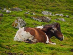
- Walking through Kirkjubøur is a true journey through time, in the quiet and the wind, which seems to tell the story of every stone wall. Nearby, beautiful Icelandic horses rest, admired not only for their incredible strength but also for their ability to survive in the harsh island climate.


RIB Speed Boat Trip to Hestur
After visiting Kirkjubøur, we head to the Gamlarætt harbour to embark on an exciting RIB speed boat trip along the coast of Hestur Island. This dynamic ride allows us to explore sea caves, weather permitting.


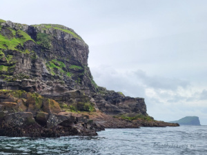


It is one of the most thrilling activities of the entire trip. The organisers take care of every detail: we are provided with warm suits, life jackets, and helmets with visors. The experience? Adrenaline, laughter, and awe — especially when the boat reaches speeds of up to 110 km/h, with wind and spray hitting your face from all directions.
We circumnavigate Hestur, visiting several caves, including the largest sea cave in the world. Inside the rocky caves, ethnic music plays from speakers on the boat, echoing off the wet walls and intensifying the experience.
On the return trip, despite the pouring rain, no one complained. On the contrary, the rain added authenticity and enhanced the incredible experience. The views were breathtaking: vertical cliffs, thousands of birds nesting among the rocks, the roar of the waves, and the power of nature. It was the kind of adventure that stays with you for a long time — an actual Faroese fantastic experience!
After returning from the boat trip, we head back to the capital. This is a perfect moment for a relaxed dinner at a local restaurant, followed by an unhurried stroll through the quieter streets of the city, soaking in the atmosphere of the far North without rush or schedule.

Additional Information:
- Rib62.com organised the boat trip to Hestur.
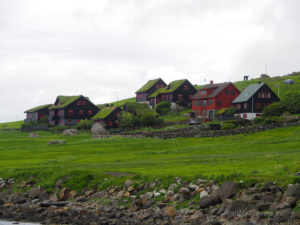
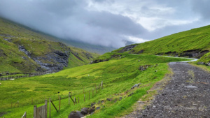
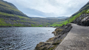
Day 6 – Saksun, Tjørnuvík, and the Black Atlantic Beach
Today, we head north on the island of Streymoy, where some of the most scenic and raw landscapes of the Faroe Islands await. Our goal is to visit three villages: Saksun, Tjørnuvík, and briefly pass by Hvalvík and Haldórsvík — the true essence of Faroese wilderness.
Saksun – River, Lagoon, and Black Beach
The first stop is the village of Saksun, nestled in a deep valley. Even the drive here is unique — a narrow, winding road snakes between the hills, and the air carries a sense that time has stood still.
We leave the car in the parking lot on the left — the start of the Út á Lónna trail, following a small river all the way to the black beach at the Atlantic Ocean. Despite heavy rain, the walk through the rocky gorge and soft sand is pleasantly easy — at least on the way back. The return can be a bit more challenging when the water level is high, but it is definitely worth it. The round trip, including stops for photos and admiration, takes about 1.5 hours.


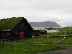
After returning, we move to the second parking lot, located near the white, turf-roofed church, which offers a spectacular view of the valley and Heljardalsa Waterfall.


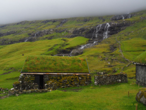


It is worth paying 75 DKK to enter the area of the old settlement, which features historic houses and a path that leads closer to the waterfall. Here, you will find Dúvugarðar Farm, a traditional 17th-century farm that now functions as a museum. You can peek inside the turf-roofed cottages and see what daily life was like for Faroese people centuries ago. Facilities include toilets, coffee, and snacks — a small Faroese oasis amid the raw nature.


Along the path, sheep graze peacefully, and colourful birds scurry among their legs, tending to their chicks. The oystercatcher, the national bird of the Faroe Islands, with its black-and-white plumage and bright orange beak, is considered a symbol of courage and bravery.


Additional Information:
- The Út á Lónna trail near Saksun is an easy and scenic route to the black beach surrounded by mountains. The trail is about 3 km one way and runs over gravel and sand — perfect for a relaxed walk. The round trip takes roughly 1.5 hours.
- Traditional Faroese architecture — low wooden houses with grassy roofs — was a practical response to the harsh climate. The grass was insulated against wind and rain, blending naturally into the landscape.
- For more information about Dúvugarðar Farm in Saksun, please visit duvugardar.fo.

Fossá Waterfall and Villages on the Way to the End of the World
On the way to Tjørnuvík, we stop at one of the highest waterfalls in the Faroe Islands – Fossá (140 m). Just past it is a tiny parking lot, only big enough for a few cars, so stay alert.


The next stop is Haldórsvík – a sleepy village with typical Faroese houses and a photogenic view from the road. The best photo spot is at the end of the town, just past the curve, where you can capture the valley and rooftops against the steep hills.


Tjørnuvík – The Village at the End of the Road
Finally, we arrive at Tjørnuvík, a tiny settlement at the northern tip of Streymoy. The access road ends in a single-lane section controlled by traffic lights — one of the more unusual driving experiences in the Faroes.
On site: a small parking area (sometimes hard to find a free spot), toilets, and a little café where you can grab a snack. From the village, a trail along the beach, worn by sheep, leads to a viewpoint on a concrete pier. This 10-minute walk is worth it to see the village from another angle and capture the view of Risin and Kellingin — the legendary giant and his wife, who, according to Faroese folklore, were turned to stone while attempting to steal the islands to Iceland.
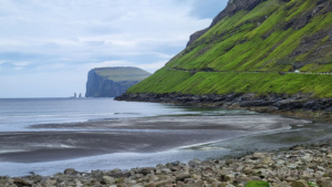


Legend has it that this pair of Icelandic giants — Risin and his wife Kellingin — attempted to conquer the Faroe Islands by tying them to their home island with a rope. However, the morning sun turned them to stone, and they have stood proud and motionless ever since — at the northern shores of the archipelago.
Road 662
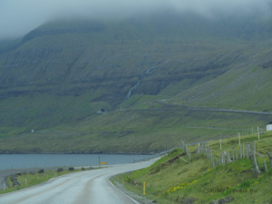
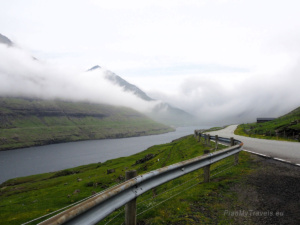
Road 662 on the island of Eysturoy, leading from the bridge connecting Streymoy to Eysturoy towards Gjógv, is one of the most scenic routes in the Faroe Islands. It runs along the Funningsfjørður fjord — one of the deepest in the archipelago — surrounded by steep slopes and mountains often shrouded in clouds. On a clear day, the views are breathtaking, but fog can suddenly descend and obscure the road entirely.


It’s worth stopping at the viewpoint just before Funningur — from here you can see the fjord in all its glory, and on a clear day, also Slættaratindur, the highest peak in the Faroe Islands. The route itself is an attraction — calm, wild, and stunning at any time of day.

Evening in Gjógv
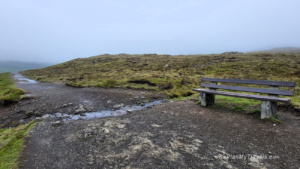
To end this eventful day, we reach Gjógv — a charming village whose name means the gorge. Indeed, the heart of the town is a natural cleft in the rock, leading to a small harbour — a place that seems sculpted by the sea for a single boat. It is also worth walking to the cliff viewpoint, where the famous Elizabeth Bench stands — named after the Queen of Denmark, who admired the endless ocean and steep bird-filled cliffs from this spot.
This is the perfect place to pause, sit, and enjoy the silence, the wind, and the flight of puffins overhead. After a day of rain, fog, and spectacular landscapes, Gjógv brings peace and the feeling that you are genuinely at the end of the world.


Day 7 – Cliffs, Puffins, and the Summer Light of the North
After a night in charming Gjógv, we start the day slowly with a walk around the village and its immediate surroundings. In the morning, a light mist still lingers, but you can feel that this will be one of those days when the Faroes show their gentler side.
Trekking to the Gjógv Cliff
In the village centre, a trail leads to the top of a cliff, part of the famous Gjógv Loop Trailhead. The path is not long, but the steep ascent — with stairs, muddy sections, and a narrow rope-secured stretch. This can be particularly challenging for those who lack confidence in their physical abilities. It can be difficult, especially on wet days, when the ground is slippery and the ocean wind can be intense.
The reward at the top is worth it: a vast plateau, a small pond, sheep calmly grazing, and… a view of the endless cliff. Here, you can see puffins — flying overhead, disappearing into burrows dug in the grass, and perching on cliff edges. Their presence makes this place truly magical.


During the summer season, access to this area may require a small fee (approximately 50 DKK, paid in a box) — it is private land, and the funds help residents maintain the trails and protect the natural environment.

Eiði and Another Royal Encounter
In the afternoon, we head toward Eiði, a village by a lake. On the way, we stop at the Risin og Kellingin viewpoint — the monumental rocks, according to Faroese legend, said to be those of an Icelandic giant and his wife, who were turned to stone.

In Eiði, it is worth parking by the church — here you will find toilets and a quiet spot for a short walk. The church interior may surprise you with its colourful décor and a model ship hanging from the ceiling, following the Nordic tradition of giving thanks for a safe return from the sea.


It’s also worth driving to the lake just beyond the village. The road leads to a small sports field, near which a summer campsite for campers and caravans operates. This is a peaceful spot with a beautiful view — perfect for a short rest or picnic by the water.

During our visit, the village was lively as the Danish royal couple arrived there. Also, the same majestic Royal Yacht we saw earlier in Tórshavn was moored in the harbour. Although Eiði is small and quiet, these unassuming places can be the backdrop for significant events.

Summer Evening in Gjógv with Puffins
Back in Gjógv, we sit on a bench by the cliff and watch. Around us, fragrant grass dotted with yellow flowers seems to have bloomed just today. Puffins, guillemots, and gulls circle above the gorge, the sea is calm, and the golden Faroese summer light bathes everything. The sun sets late, shadows are long, and everything feels softer, as if from another time.


It was another long day, full of joy, unforgettable experiences, warm sunlight, and peace. And although we will hit the road again tomorrow, today there is no need to go anywhere.
Day 8 – Northern Tunnels and a Lakeside Walk
Today we leave our hotel in Gjógv to visit some of the northernmost corners of the archipelago. The route is scenic, crossing several islands and featuring spectacular tunnels — including the famous narrow tunnels from the 1960s, where traffic is regulated by green lights that appear every few minutes. Driving through the toll Norðoyatunnilin, the underwater tunnel connecting Eysturoy with Borðoy, is an experience in itself.

Viðareiði – the Far North

Our first stop is the tiny village of Viðareiði on Viðoy Island, where the road ends and silence begins. The drive through mountains, curves, and small bridges feels like a journey to the northernmost edge of the Faroe Islands. We park in a large lot next to the town hall and walk toward the church by the bay. Although the building is closed, it looks stunning against the backdrop of mountains and ocean.

In the village, we notice a small park with a pond and walking paths right by the road. It is a quiet spot with benches and local art. On the school wall, a graphic inspired by the poetry of a Faroese artist illustrates the residents’ connection with nature and history.


In the distance rises Enniberg, one of the most inaccessible peaks in the Faroes. Only the most experienced hikers attempt it — we stay at sea level, soaking in the raw beauty of the area.
Klaksvík – Modernity Meets Tradition

After visiting Viðareiði, we return through a tunnel to Klaksvík on Borðoy Island, the second-largest town in the Faroes. Nestled in a deep bay and surrounded by mountains and fjords, Klaksvík blends modern architecture with local character.


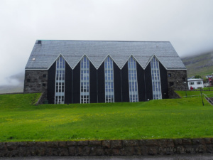
On a hill stands Christianskirkjan, built from basalt and wood — monumental yet straightforward. If open during your visit, it is worth taking a moment to step inside!

For lunch, we head to Café Frida, a cosy restaurant offering homemade dishes. The menu features fish soup, salads, a local burger, and the famous Faroese bagel sandwich. Café Frida is a popular spot, so booking a table in advance is highly recommended. The building also houses toilets and a small souvenir shop. Reservations and menu info are available on Café Frida’s website.
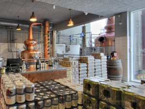
For fans of local flavours, the Føroya Bjór brewery offers regional beers with unique labels — a perfect souvenir. Brewery tours are also available.


Evening in Runavík – Lake and Nature
After lunch, we continue south to Runavík, a town on the Skálafjørður Fjord, the archipelago’s longest and deepest fjord. By 6.00 PM, most shops and cafés are closed, giving the perfect excuse to focus on nature.
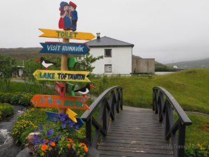

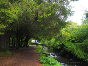
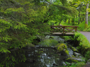
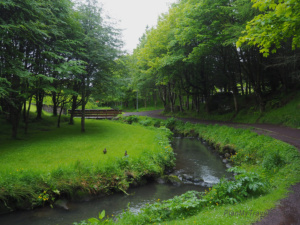
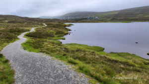
An ideal way to end the day is a walk around nearby Toftavatn Lake, about a 10–15 minute walk from the town centre. The fourth-largest lake in the Faroe Islands, it is renowned for its stunning landscapes and diverse birdlife. The circular trail along the small, flowing stream takes about 30–40 minutes and is perfect for a peaceful walk. The trail runs along a small, rushing river, is gravel-lined, lighted, and equipped with benches.

The sight of the lake itself is breathtaking – the calm surface of the water reflecting the surrounding mountains. The looping path around the lake is about a 30-40-minute walk and offers extraordinary natural beauty. The surroundings are full of mosses, mushrooms, and algae, creating a colourful, almost fairytale-like landscape. It is a space where you can truly breathe.


Useful Information:
- Christianskirkjan in Klaksvík is open to visitors from May 1 to September 15: Monday–Friday, 10:00–16:00, Saturday, 10:00–13:00. Sunday services at 11:00 are restricted to photography. For more details about the history of the church, please visit the King Christian Church website.
- The route to and from Viðareiði includes three tunnels, including the oldest and the toll tunnel, which is narrow, dark, and carved into rock, providing an experience for many drivers. More information on tolls is available on the Faroes road tolls website.
- The Toftavatn Lake trail can start in the centre of Runavík or from the Bylgjan Stadium parking. The walk takes about an hour, is easy, and is ideal for birdwatching, especially in May and July when puffins are visible.
Day 9 – Lake Suspended Above the Ocean and the Witch’s Finger
Today, we return to Vágar Island, travelling through spectacular tunnels connecting the Faroese islands. Along the way, we pass the Eysturoyartunnilin, a modern tunnel featuring an underwater roundabout that resembles a light installation more than a road junction. We also pass the classic Vágatunnilin, which leads directly onto Vágar.
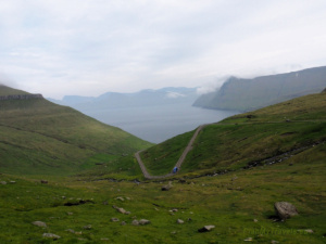
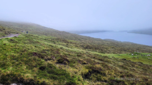
Sørvágsvatn Lake and Trælanípa Cliff
Our main goal today is a trek to Sørvágsvatn, the largest freshwater lake in the Faroes. The trail starts in the village of Miðvágur, near a small café and souvenir shop. This is also where the entry fee is collected (200 DKK), and toilets are available.
The hike follows the lakeshore — gentle hills on one side, water and broad perspectives on the other. In good weather, the view from Trælanípa Cliff is one of Europe’s most spectacular! You can spot there how the lake appears to hang dozens of meters above the Atlantic Ocean.
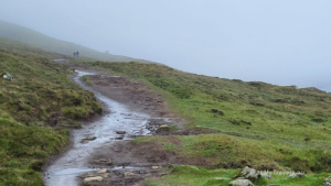
The trail continues to Bøsdalafossur Waterfall, which crashes directly into the ocean. On our visit, fog enveloped the area, and rain and mud made the path technically challenging. Nevertheless, we reached the cliff edge, where the vertical rocks were breathtaking. The round-trip hike took approximately three hours.


Tips:
- Trælanípa Cliff, also called the Slave Cliff, was, according to legend, where Vikings threw rebellious enslaves. Today, it is an iconic Faroese landmark, visible from planes landing on Vágar.
- The trail around Sørvágsvatn can be very muddy. On rainy days, slippery sections make proper hiking boots essential.
Sandavágur and Trøllkonufingur – the Witch’s Finger
After the hike, we relax and have lunch at Café Zorva. This establishment, situated near the airport, serves good food at reasonable prices.
In Sandavágur, we start with a visit to the Shepherd of Sondum monument.

It commemorates the legend of a shepherd who accidentally took a giantess’s dress. Angered, the giantess chased him, but he escaped to a church — a place where giants could not enter. From the dress, only one sleeve remained, which was turned into a clerical cloak still used in Sandavágur church. The monument combines local history, beliefs, and traditions that have been passed down through generations.

We stroll through the village, visiting a small red church with carved decorations. We are stopping at a Faroese poet’s monument and taking in the views of the river flowing into the ocean. The village is quiet and almost deserted after 6 PM.


Finally, we take a short trek to the Trøllkonufingur viewpoint — the Witch’s Finger. According to legend, a giantess tried to carry the Faroes to Iceland but was caught by the sun and turned to stone. Today, her finger juts out of the ocean.


From a small parking lot, the trail follows a gravel path. Crosses a rushing river via a bridge and climbs to the cliff edge. At 313 meters high, the view is dramatic, spectacular, and almost entirely free of tourists. It is worth taking the time to experience the wildness of the landscape and watch seabirds soar above the ocean. The trail is 1,400 meters one-way and takes approximately 20–30 minutes, depending on your walking pace.


Day 10 – Faroe Islands and Farewell
In the morning in Sandavágur, the world still seemed asleep, wrapped in thick fog and drizzle. The weather — as if in tune with our mood — bade us farewell in a truly Faroese way: calm, cool, with a hint of melancholy.
We made a quick stop at a local shop. Prepared sandwiches and tea for the road, and headed toward the airport. Our final stop before departure was a gas station, where we refuelled the car and grabbed a farewell coffee.
At the airport, we returned the car and keys. Fog covered the hills around Vágar, and the rain tapped steadily on the windows. It felt as if the Faroe Islands were quietly telling us it was time to leave.
Waiting for the gates to open and for our baggage check, we looked out one last time at the silent landscape. We said goodbye without words. Goodbye to a place remembered not for attractions, but for its silence, vastness, and the feeling of being very, very far away
The Faroese Silence
The Faroe Islands are not a place of spectacular attractions calling for attention in travel brochures. They do not attract crowds or try to charm visitors. They are as they are — wild, rugged, often shrouded in fog and rain. But if you allow them to get under your skin, they stay with you.

This is a journey unlike any other. Instead of a checklist of sights, there is silence. Instead of city noise, the sound of wind and birds. Finally, instead of fleeting attractions, everyday life is where residents have learned for generations to coexist with nature. We had the extraordinary opportunity to step into that daily life, even for a moment, and feel it ourselves.
Every day in the Faroes is a reminder that we are not the most important. True beauty can be demanding, wet, uncomfortable — yet authentic. That is why it moves you so deeply.
This is a place that needs no embellishment. Just look from a cliff at the black beaches, watch a puffin in flight, smell the grass after rain and suddenly, everything slows down.
Faroese silence has its power. And though you return chilled, your heart somehow feels warmer.
Faroe Islands – Summary
The Faroe Islands have elements of Iceland and Scotland. There are rugged landscapes, untamed nature, humidity in the air, and wind that never stops. Yet they are entirely different. Quieter, more secluded. As if hiding at the end of the world, wanting to remain undiscovered.
This is not a destination for everyone. It is not a tropical holiday, nor a top 10 Instagram city break. It is for those who can find beauty in emptiness, in foggy mornings, in rain and wind that tangles your hair and thoughts. For those who value solitude and can listen to silence.

I hope the Faroe Islands will never become overly commercialised. I also hope that they remain remote, rugged, and authentic. Only then will they keep their true character.
I would love to return someday — not for attractions, but for the endless sky, ocean, and green hills. For the silence. For the feeling of being far away from everything.
*Links to the Guide to Faroe Islands offer are affiliate links.